Loading...
Saimaa Geopark -site: Sarkaslampi Bedrock Topography

Saimaa Geopark -site: Sarkaslampi Bedrock Topography
Sarkaslampi is one of the geosites in the Saimaa Geopark. The route, which showcases the rugged lake landscape, has three ancient monuments: a prehistoric quartz quarry and two rock paintings.
You can explore these sites on the Sarkaslampi georoute. The trail is demanding and not suitable for children. A reasonable level of fitness is required to complete the trail. The trail is marked with yellow signs. Sarkaslampi, located in Uimasalo in southern Juva, is part of the Saimaa Luonteri Natura conservation area and the Luonteri shore conservation area.
Wilderness and rugged rock landscapes
The most notable feature of the Sarkaslampi area is its exceptionally rugged and impressive rock landscapes. The shores of Sarkaslampi, a nationally valuable small water body, open up into the environment as massive, open rock walls, emphasizing the rugged, wilderness atmosphere of the rocky landscape. The narrow depression formed by the cliffs on the eastern shore of Ristilampi has a cave-like atmosphere, with the cliffs rising to a height of about 20 meters on both sides of the trail. In the gorge between the rocky cliffs, hikers will encounter a small fern forest with streams and evergreen trees, while at the southern end of Sarkaslampi, a boggy swamp opens up.
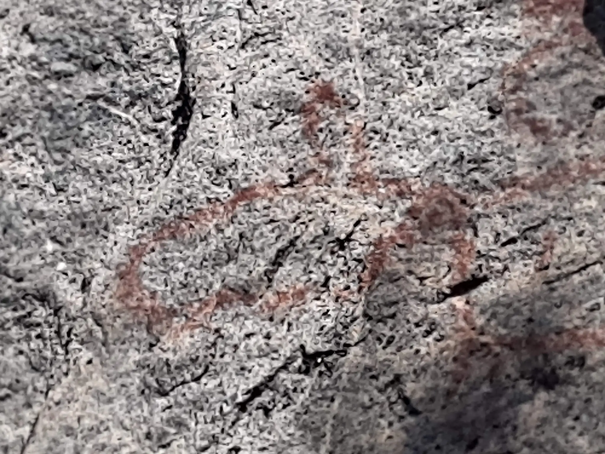
Ancient monuments at Sarkaslampi
There are three historical sites along the Sarkaslampi geotrail: a prehistoric quartz quarry on the eastern shore of Ristilampi and two rock paintings at Sarkaslampi. The most famous of the rock paintings is probably the Juvan hirvi (Juvan elk), painted about three meters high on the rugged cliffs of Sarkaslampi. Another moose-themed rock painting, which is less visible, is located near the Juvan hirvi. A boat-themed rock painting is located closer to the southern end of Sarkaslampi. After a little searching, the painting can be found at the ancient monument symbol marked on the terrain map, about three to four meters above the path.
Your feedback is important
Did you enjoy this information?

Theme