Three-Country Cairn

Three-Country Cairn
Distance:
22 km (Kilpisjärvi)
Estimated time:
5-6 hours
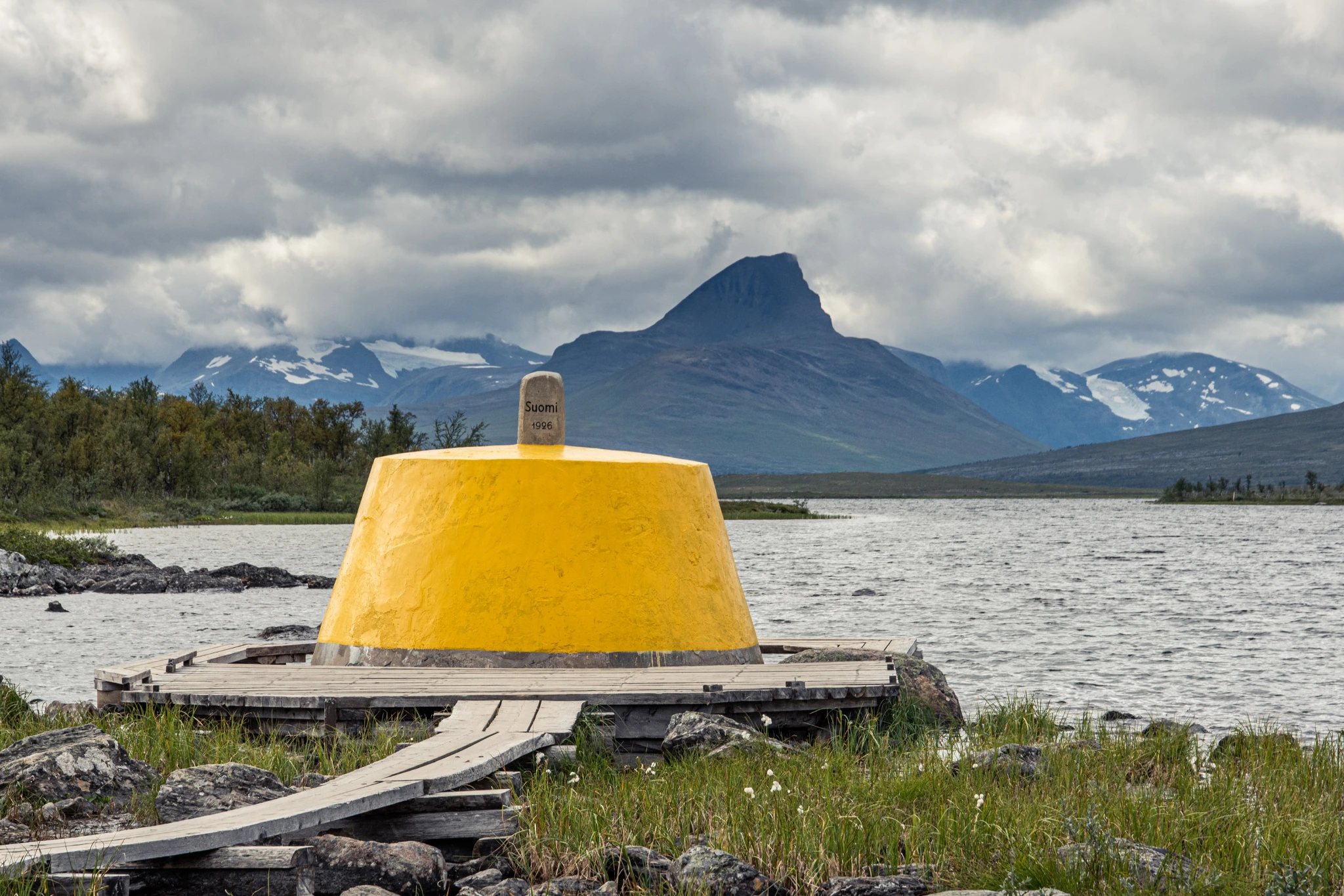
This is the world’s northernmost three-country cairn, marking the point where Norway, Sweden and Finland meet. It’s the only such place in Norway, where you can walk freely between the three countries at the same place.
There are various ways of reaching the three-country cairn. You can walk here from the Signaldalen valley (two-day hike) or drive up to Kilpisjärvi in Finland and start walking from the car park just across the border.
From Kilpisjärvi: Park at the large car park just across the Finnish border. The path is clearly marked all the way.
Alternatively, in summer you can take a scheduled boat across the lake and walk approx. 20 min along a marked path all the way to Treriksrøysa, the three-country cairn.
Alternative: A longer hike from the Signaldalen valley/Čiekŋalvuovdi via the Gappohytta and Goldahytta cabins (approx. 30 km)
Starting point
There is a large car park by the E8 just across the Finnish border
Sticks in the ground with orange marks
Elevation:
490 m a.s.l. at the cairn
If you are in Kilpisjärvi you can access their visitor map here.